Existing ecological and urbanisation realities and the ban on night traffic inside PAs of Nilgiri Biosphere Reserve
In a nutshell
Banning traffic/ closing existing roads inside prime PAs and diverting the same to roads in adjoining forests is like dumping your city's garbage in surrounding villages.
Banning traffic/ closing existing roads inside prime PAs and diverting the same to roads in adjoining forests is like dumping your city's garbage in surrounding villages.
Background
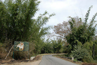
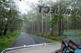
The contiguous forest cover of interior peninsula India surrounding the junction of Eastern and Western Ghats (peninsular India's green crescent as I like to call it) from Biligiri Ranganatha Swamy Temple (BRT) (Chamarajanagar District in Karnataka) up to Kempuhole (Hassan Dist, Karnataka) and beyond has several major roads that pass through forests. On one hand while these roads cut across wildlife corridors and habitat of big game - herbivores like elephants and gaur as well as big cats like the tiger, they also are lifelines for tens of thousands of humans, including marginal farmers who use them to transport their produce to the major markets of the region. Inside this green crescent are a string of protected areas many of which, along with some reserve forests, comprise the Nilgiri Biosphere Reserve (NBR), India's first.
 |
| Please click for larger size |
Within the last 4 years, a couple of existing major inter-state roads inside well known protected forests of NBR have been closed for night traffic, after studies showed high number of road kills in on those forest roads, particularly at night. The Antharasanthe check post - Udburu turn section (between Bawali checkpost and Antharsanthe) of the Manathavadi - Mysore road, a major inter-state highway has been closed even during day and vehicles now take a severe beating on the adjacent pot hole filled, single lane village roads. I drove on these 'alternate' roads in Aug this year (2012).
 |
| A mouse deer run over on the Maddur - Muthanga stretch of Mysore - Sultan Bathery road inside Bandipur Tiger Reserve. (Pic Jun 2011) ©Ameen Ahmed (All rights reserved) |
a) Mananthavadi - Sultan Bathery - Maddur forest (Bandipur) - Gundlupete: Forest closed at night as it passes through Bandipur tiger reserve.
 |
| A wild Asian elephant trying to cross the Maddur - Muthanga stretch of Mysore - Gundlupet - Sultan Bathery Road inside Wayanad wildlife sanctuary. (Pic Jun 2011) ©Ameen Ahmed (All rights reserved) |
 |
| Kakanna halla gate - Bandipur complex stretch of Mysore - Ooty highway. (Pic Jan 2009) ©Ameen Ahmed (All rights reserved) |
 |
| A view of Moyar Valley forests in Nilgiris north division, with the hill forests of Satyamangalam tiger reserve in the far background. (Pic Oct 2011) ©Ameen Ahmed (All rights reserved) |
 |
| Southern entrance of Nagarahole (Rajiv Gandhi) national park near Kutta village on the Kutta - Hunsur road leading onwards to Mysore. (Pic Sep 2001) ©Ameen Ahmed (All rights reserved) |
*As predicted this traffic has begun to take a toll of the wildlife, particularly at night. Check this story (Times of India, 14 Nov 2012) http://timesofindia.indiatimes.com/city/kozhikode/Animals-caught-in-the-headlights-takes-heavy-toll/articleshow/17211842.cms
Heavy traffic will split the Makutta wildlife and territorial ranges and restrict movement/ affect migration of wildlife between the wildlife sanctuaries of Talakaveri (in the west) and Brahmagiri (east).
One doesn't need much convincing that the human population has increased and so has the buying power of these people in the past two decades, the later particularly since India's economic liberalisation in early 1990s. Question is, what gains are made by closing one road inside a PA only to push the traffic to an adjoining one again in the forest?
My observations of the human-wildlife conflict
I have been visiting the forests of NBR at an average of twice a year since my first visit as a serious nature observer in Jan 1993. I have taken part in quite a few wildlife surveys and estimation exercises across NBR since then, getting rare opportunities to walk through a vast majority of NBR's reserve forests - wildlife and territorial. A few months ago I was fortunate enough to eyewitness a researcher at work to study the human-elephant conflict (HEC) in the Western Ghats districts of Nilgiris, Wayanad, Kodagu and Hassan. In June 2011, as part of an assignment with my previous employer, I had a chance to drive through much of this green crescent with him from Gundlupete, Mysore Dist in the centre of NBR northwards to Sakaleshpur, Hassan Dist through Bandipur-Wayanad-Nagarahole PAs and Coorg (Kodagu) & Hassan Districts' forests.
From what I understand, the human elephant problem adjoining Tithimati forests along Gonikoppal - Hunsur road in Kodagu Dist and the forests northwards in Kodagu's Somwarpete taluk along its borders with Hassan Dist, is more intense than around Kabini reservoir surrounding Nagarahole and Bandipur PAs, if the number of people being killed is a measure. There is data & reports prepared for Project Elephant as well as Govt of Karnataka which will probably tell us why the forested stretch of the Hunsur - Gonikoppal highway is a better candidate for 'night curfew' than the Bawali checkpost - Antharasanthe stretch of Manathavadi - Mysore highway.
Our PAs are being increasingly isolated from the landscapes surrounding them. As a serious wildlife enthusiast I see tremendous destruction these days in the non-protected area forests all around me, NBR not being an exception. The rate at which natural resources (sand, wood, granite etc) are being extracted from the smaller forests, the day is not far when the big PAs will inevitably have to be opened up for these activities. After all they are a part of the same landscape and the country we live in and cannot be kept isolated into posterity.
As a nation how we overcome the threats from an ever increasing human population becoming urbanised and tackle their fetish for consumerism, will determine the future of our wildlife. For that the entire landscape needs to be looked at, meaning 100% of our nation, not just the 4-5% PAs that seem so tempting to work on as they provide easy headlines. The 4-5% is going to be gobbled up sooner or later if the rest is not taken care of. Whether we still want to cling on to the 4-5% argument is our choice.
Any solution?
The traffic flowing through our PAs like that in NBR is a symptom. Wildlife slaughtered by such traffic denotes something wrong, a bigger problem. Banning traffic through selected roads is first aid, not a permanent solution. It cannot work in the long run and will be a missed opportunity if we soon do not come up with strategies and action plans to tackle the larger issues.
In conservation,
Ameen Ahmed
http://tumkurameen.blogspot.com
Cell: Nine zero three five triple eight four two nine


Hi Ameen,
ReplyDeleteA very well documented Article, I've always advocated proper land use planning in and around urban towns and rural towns. Our planning strategies are very short sighted and are absolutely not prepared for what lies ahead. For example if the Government of Karnataka would've shared and equally take up projects pertaining to IT and ITES in Karnataka, Bangalore would not have seen so many complications like traffic jams, pollution and so on. If the Government had identified other important towns in Karnataka where similar investments were made then I guess the state (local population) as a whole and the skilled workers would've greatly benefited. It would not end up choking a single City or Town for that matter as the workforce is equally distributed. In my humble opinion I guess the only feasible approach to this problem is to lay new roads cutting through certain areas of the forests where the impact of animal casualties are at a negligible level and as long as it does not deter any important corridors in any way. This however can be achieved only after an intensive study is conducted in areas identified, having said this I wonder if this is feasible as one PA is connected to another one especially in the NBR Region. Or I guess the other way to tackle road kill is to come up with a device fitted to a vehicle that emits sound clearly audible to the animals warning them of any approaching vehicles, it has to be of Low Frequency and not audible to Human kind. I bought one such device from Canada and fitted it in our car as we travel a lot especially on the Guwahati-Dibrugarh road which cuts through Kaziranga NP. Again to test its effectiveness a study has to be conducted before putting it to practice. And I guess if we stick on to the 'Easier said than done' attitude we will never get anything going.
When the busy Bandipur-Mudumalai road was closed I was overjoyed, little did I realize that the brunt of this Closure would take a toll on the denizens of the forests in other places. Your Article was an eye opener for me.
Thanks & Regards,
Siddhartha Kumar Gogoi
Ameen,
ReplyDeleteGood to see another article after a long time. I never realised the effect of the closure of one road. You are so right. A band-aid is not the permanent solution. I wonder if there is any other solution at all. Please keep posting more frequently. You are my only window to the life of other creatures back home.
Ameen,
ReplyDeleteNice to see your post after a very long time.
I understand the roads cannot be closed in totality as the NBR is one contiguous stretch and to connect places it has to pass through this stretch somewhere.
Would closing them at night (as being done now) and having a regulated traffic help in solving the problem to some extent?
Also, can't we have a speed monitoring system in place like maintaining in & out time (based on 20-30km/hr) and impose a fine on vehicles if out before the specified time duration or exceeds the specified duration with speed guns installed at various places?